European Vegetation Pulse – “Update for the year 2024”
Initially based on toolbox and dataset experience proposed by EUMETSAT, within their climate applications training sessions.
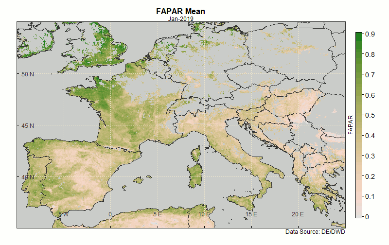
The proposition here is to consider a view of the European territory by satellite over a year (2024), by animating the visualization of the FAPAR Vegetation indicator along the year, based on a synthetic observation series every decade.
Such animated observation mode (Vegetation variations loop) may visually reveal phenomena and constitute a precious didactic material to develop dedicated case-studies.
Partnership with
Case-Study_Eumetsat_GeohALL_Vgt-Pulse-2024.pdf