GeohALL Consulting develops an approach combining local and multidisciplinary teamwork using advanced EO & Mapping technologies, taking advantage of open data imagery sourcing (COPERNICUS, …), opensource tools (OSGEO, …), and cloud infrastructures.
Vegetation Monitoring Benchmarking
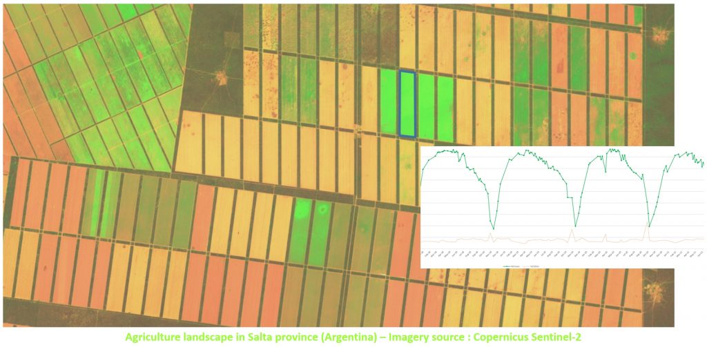
The purpose is to setup and maintain a synthetic and updated benchmarking of the operational Vegetation Monitoring solutions.
This prospective initiative is based on a partnership with the different major actors developing and proposing monitoring solutions. Several representative entities are tested: (1) Annual crop fields in Europe (2) Annual crop fields in Argentina (3) Annual crop fields in Mali (4) Forest Restoration in Indonesia (5) Littoral Ecosystem in Comoros …
The result is a permanent reporting on the state-of-art, and the capacity to propose and implement the more relevant solution to address specific monitoring demands.
Sponsored by ![]()
Status: in progress